Monday, April 29, 2013

Our World Cruise Finale - Castries, St. Lucia

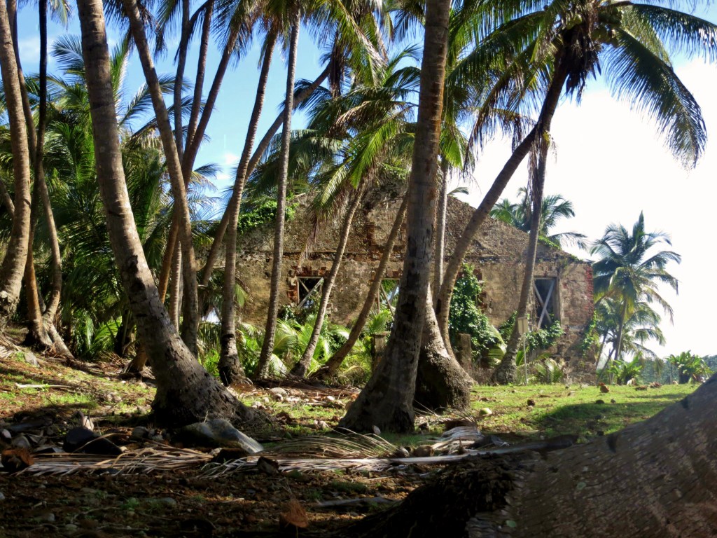
UNESCO World Heritage Site - Gros & Petit Pitons

On January 5 when we boarded the ms Amsterdam, our final port of this world cruise seemed so far in the future that we hardly gave it a thought.  We have not been Caribbean travelers except for Dominica and Barbados on last year’s world cruise and now St. Lucia. I had heard more than one person comment that St. Lucia was their 
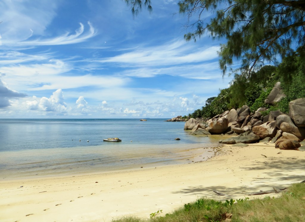
favorite Caribbean island and our sail in seemed to confirm the beauty here.  As we rounded the southwest corner of St. Lucia, the two dramatic peaks of Gros Piton and Petit Piton were clearly identifiable.  Hard to believe as it was, we were approaching our very last port!

A few quick comments about St. Lucia, but in not as much detail as usual for two reasons.  One reason is that as I begin this, we have three full days left to get everything packed up to go from our home for the last four months to our real homes!  Suitcases are all in the room and “stuff” is all over the place, some in packing cubes, others hidden temporarily in suitcases to get them out of the way, and still more not having been removed from shelves or drawers yet.  Needless to say, the next few days won’t be our favorite part of the cruise.  That needs to take priority, but I want to get the St. Lucia blog posted as quickly as possible.

Many of our friends have more expertise on the Caribbean islands than we do, but I will make a superficial attempt to comment on this beautiful island.  It’s located in the Southern Caribbean, about 1,335 miles from Ft. Lauderdale and is between Martinique and St. Vincent in the Windward chain.  It’s about 27 miles north to south and 14 miles east to west with a population of approximately 160,000 inhabitants most of whom are Roman Catholic.  The vast majority are of African descent.  It’s a mountainous island as we learned firsthand and still has an active volcano called La Soufrière.  Although there is a constant release of sulfur gas, there hasn’t been an actual eruption since the 18th century. 

The mountains are heavily forested with trees, many of which are palms and bamboo.  The economy is heavily agricultural and bananas thrive in this tropical climate.  Our guide showed us some of the large banana plantations with blue bags over the large bunches of the fruit.  The actual banana flower is purple and it takes 7-9 months to have the bananas ready to harvest. At that point, the process begins again.  In addition to bananas, mango, papaya, breadfruit and many more tropical fruit are found in abundance.

The island was settled by the Arawak Indians from South America in about 300 AD and then by the Carib Indians (note Caribbean Sea) between 800 and 1000 AD.  Over the years, St. Lucia has gone back and forth between Britain and France a total of 14 times. In fact we saw some old barracks, now part of a community college, that were used by both Britain and France depending upon who was controlling St. Lucia at the time.  By 1967, St. Lucia became an associated state of the UK and in the late 1970s, St. Lucia achieved independence.  While some Creole is spoken, English is the official language.  Our tour guide did tell us, interestingly, that there is no unemployment insurance in this country with a high unemployment rate, so people are on their own if they don’t hold a job.

Our arrival in St. Lucia was on schedule despite the three hours plus delay in leaving Devil’s Island because the tender door to the ship wouldn’t close on Thursday.  We were safely docked by 10 AM and had a chance to watch the scenic sail in from our verandah as well as from the LaFontaine Dining Room during breakfast.  At one point, Barb looked out and shouted, “Dolphins!”  Everyone including the dining stewards rushed to the window to see maybe 20 dolphins jumping and playing near the ship.  We commented that we had never seen dolphins jump so high out of the water as these energetic guys!  Some seemed literally to jump straight out of the water rather than skimming in horizontal positions!  It was a wonderful sight and our best view of dolphins of the entire cruise.  And it took 112 days to see it!

As soon as the ship cleared, Barb and I went out to the shops just below the ship because we knew we needed to get back to be ready for our 10:30 shore excursion compliments of AAA.  Our tour, Volcanic Island and Plantation Tour promised to be a good, full tour of this beautiful mountainous island.  Normally AAA arranges for two large buses with plenty of room for everyone.  This time, however there were three buses which might have been a clue that things would be different this time.  For shore excursions, we tend to be early so as to get a good seat on the tour bus so Barb can extend her leg and foot for more comfort.  We were assigned a bus and were among the first on the small bus.  We found a double seat but this was a bus with single seats along one side.  Then we made our first huge mistake that proved to be the undoing of this day for Barb.  Before many got on, we decided to move to two single seats, one in front of the other.  Barb decided to take the seat directly behind the door that would allow her leg room so she could extend her foot into the opening by the door.  A few more got on but we still thought nothing of it.  A final couple boarded and had to take some rather undesirable seats way up front, one of which was intended for the guide.  They had to take a big step up to the front and sit with knees nearly on their chins ­– not too comfortable for older people.  A wheelchair for one of the people was outside the door and I anticipated that it would be put under the bus.  Wrong!  The guide put the wheelchair on the bus itself and placed it in the doorway of the bus, directly in front of Barb.  Then the guide pulled down a folding seat right next to Barb and the people across the aisle that would allow four people to sit directly across.  Now Barb could neither extend her foot ahead because the wheelchair blocked it and couldn’t stick her foot into the aisle because the tour guide was sitting directly next to her.  The guide was unable to sit farther back as her mike cord wouldn’t go any farther back than where Barb was sitting.  I agreed to change places with her at our first stop, a scenic overlook of the city of Castries and the beautiful tropical harbor.

We told our AAA rep, Gloria that the seating was most uncomfortable and very tight and that Barb had no legroom.  I wasn’t happy with riding for an extended period without any legroom either. To make matters worse, there was no place to put the few things we had brought on board and no holder for the bottled water we each received.  This was the smallest, most uncomfortable bus either of us had ever had to sit in for a tour!  Gloria offered to take the place with no legroom and despite my protests that I could handle it, she insisted on sitting there in that very cramped position.  I went to the back of the bus, past the unfortunate individuals who had their feet over the wheel wells, and sat in the middle of the back of the bus.  They only thing I could say was that I had legroom but no view out of the bus at all. When I asked Barb if she wanted the legroom or the view, she opted for legroom, so we traded.  The second big mistake of the day!

Our next stop was a combination potty break and scenic photo overlook.  We were to have 10 minutes there, but we were the third of the three buses to arrive at the location.  There was one bathroom each with over 60 people on three buses to be accommodated – in 10 minutes!  I chose to take the photos first and get in the line after the pictures.  Barb got in line near the back immediately and spent virtually her whole time in line.  By now she does not seem to be a very happy camper. (How could one blame her?)

Back on the bus, we continued south toward the Petit and Gros Pitons, through small villages with small colorful home fronts in Anse la Raye and Canaries.  Houses were practically at the street and lots of people were out along the street.  We drove through the winding mountainous roads around hairpin roads.  Scenery was wonderful but we were moving so fast and foliage was so thick it was difficult to view the beauty.  We had driven through the village of Soufrière named for the town’s sulfur springs from the inactive nearby volcano, La Soufrière which belches the sulfur which was visible from the road below.  We made a couple of short stops to view the spectacular Petit and Gros Pitons, the trademark legendary mountains that identify this island. 

When we arrived at the Morne Coubaril estate for our St. Lucia buffet lunch, we were serenaded by a typical Caribbean steel pan orchestra while we ate.  The estate was originally a part of an estate commissioned by King Louis XVI and cultivated from the 18th century into the early 20th century.  We watched a skillful man shimmying up a coconut tree to shake the coconuts down to the ground.  Another man used a machete to cut into the coconut and offered those who wished a beverage of coconut milk.  We have tried it in other places and don’t find it especially refreshing, but I guess it’s a personal taste.  We moved on to taste a ripe cocoa bean before entering the building where a demonstration was conducted of the fermentation of the bean. A young man stepped into the huge vat and stomped on them much like the old process of grape stomping.  Outside, a mule-driven sugar cane mill was demonstrated.  Then we were shown the wide variety of tropical fruits grown in St. Lucia,

I asked Barb if she wanted to trade seats but she stayed in the middle of the back seat, not knowing that the worst was yet to come.  We were ready for our 1½-hour non-stop ride over the same route back to Castries.  The bus driver must have wanted to get done quickly or he wanted to set a speed record for driving the route.  He whipped around the curves at breakneck speed with that unsecured wheelchair in the doorwell.  We did the 1½ hour tour as identified in the description in just one hour!  We weren’t behind schedule as we got back a half hour earlier than the description indicated.  What I did not know until the end was that one of our friends, Carol, got sick on the bus and ruined a travel bag in the process.  Another lady was on the verge of being sick and Barb was in tears when I got back to the ship.  I had stopped to browse the shops at the pier while she had said she just had to get back on board.  It was then that she told me about the ladies who got motion sick and that Barb was being whiplashed from one side to the other as the bus moved along the winding roads.  Not only that, but those in the back could feel the rear fender hitting the pavement as the bus raced down the road.

I spoke to the AAA reps, Jack and Gloria, who had accompanied us and told them of what had transpired at the back of our bus.  Needless to say they were unhappy with what had happened too and then told me that when they were assigned three buses of that type for over 60 people, that five people had signed up for the tour and didn’t come.  Those five would also have been added to the three buses and five more people would have been crammed on the fold down seats too!  Four, instead of three, buses and a bus driver that drove more safely could have handled those issues.  We were fortunate that there wasn’t a quick stop that could have sent the unsecured wheelchair flying because we typically see those in compartments below the bus!

All in all, what would have been a beautiful drive under other circumstances was turned into a virtual nightmare for some tour members.  I experienced no problems other than being jammed into a small seat with no room to put the few belonging I had brought, but others had a much more difficult and less enjoyable time. St.  Lucia is a gorgeous island and the weather was perfect.  We need to come back someday and truly appreciate what it has to offer.

And now it is a straight sail back to Ft. Lauderdale and disembarkation on Wednesday morning and hopefully a smooth flight, not encumbered by furloughed air traffic controllers!  We will try to post one more blog after we return home to culminate what has truly be a second “trip of a lifetime” filled with good memories that should make the few unfortunate events fade in our thoughts.

It is truly a beautiful world with so much to see, so many friendly people, so many interesting cultures, different animals to appreciate …and so much more to learn and to see.

CT

Friday, April 26, 2013

Marooned on Devil's Island?

Prison Building on Devil's Island

It was pretty amazing to see the Atlantic Ocean as we sailed away from Belem, Brazil!  Our last blog entry indicated the tremendous volume of the watershed for the Amazon, but we had no idea that the waters pouring into the Atlantic would make the ocean brown for miles and miles!  We left Belem in the late afternoon of the 23rd, and even as late as mid-afternoon on the 24th as we sailed ever northward, crossing the Equator for the final time, the ocean waters were brown.  The captain referred to the striping of the waters, and indeed, we could see what looked like small white stripes running through the surface of the water as we sailed.  We found it absolutely astounding that the color of the ocean would be affected so far away from the mouth of this tremendous river!   

The day at sea between Belem, Brazil and Devil’s Island, French Guiana was notable for more than just the brown color of the ocean!  We finally bit the bullet and asked our cabin stewards to deliver a couple of suitcases to our room.  So the daunting task of packing has begun.  When we packed at home, we started the task in late November, knowing that we would be leaving home on New Year’s Eve.  Now we will have to pack everything up in less than a week!  However, the big difference here is that we only have to decide which suitcase to put our possessions into because everything must go home.  It’s a task we dread, but it will get done between now and April 30th when we have to put our suitcases out.

Because of our 5-star Mariner brunch, I wasn’t able to go to the theater and hear the drum roll along with the announcement of the photo contest winners.  No big deal because I’d only entered so I could get 8x10 prints of a few of my favorite pictures.  So later in the day I went to the photo gallery and asked the department manager Lisa when I could pick up the prints.  We’d kind of gotten to know her because she’s been the HAL representative on several of our shore excursions in Africa and again Brazil.  She asked for my cabin number, and when I told her, she went to the back room and came out with a folder, saying, “Congratulations!  You won 2nd place in the landscapes category!”  Oh, my!  What a surprise!  I was thrilled, needless to say, and to think that the picture was hurriedly snapped out of a bus window in the Seychelles makes it even more amazing!  Timing was everything, I guess!  I had a choice of three prizes, and I opted to have 50 of my own pictures printed as 4x6 prints.  Of course I had nothing else to do but to go through the thousands of pictures I’ve taken and choose 50, but the sooner, the better, I figured, which turned out to be a good decision.  When I handed them my flash drive with the pictures, the person who took it commented, “It’s a good thing you gave this to us now.  We’re running out of 4x6 photo paper!” 

Beach scene on Praslin Island, Seychelles
(my 2nd place finish)

Our last tender port was a very unique and interesting place. Located just 9 miles from the coast of French Guiana, Devil’s Island is known for having been a French prison. 

French Guiana (which can also be spelled Guyana) is the oldest overseas French department and is located on the northern coast of South America. The name Devil’s Island is used to refer to three islands very close together who lie about nine miles off the coast of French Guiana.  Devil’s Island is actually one of the three Îles du Salut, which also includes Île St. Joseph and Île Royale.  Although nobody lives on these islands now, their grim history makes this a fascinating stop!  For about 100 years starting in 1852 these islands were the most infamous prison in the French penal colony system.  Those who were sentenced to Devil’s Island were doomed to a grim life.  If a prisoner was sentenced to less than eight years, he was required to do an equal amount of time on the mainland.  If he was sentenced to more than eight years, he was never allowed to leave the island again.  The French depended upon the climate as well as malaria to finish off those prisoners who managed to hang on.  Those officials who were assigned to command this prison were not exactly the “cream of the crop”, and their often sadistic methods were ignored by the French government. 

Île St. Joseph was used for solitary confinement and was the burial ground for prison wardens.  Those prisoners who died were dumped into the sea to become shark bait. Île Royale was the main prison, and ruins can be easily seen, some still containing the graffiti of the convicts sentenced there.  Île du Diable became best known for its most famous inmate, Captain Alfred Dreyfus.  In 1892 Dreyfus was falsely accused of attempting to pass military secrets to the Germans. His only real “crime” was being Jewish in an era of strong ant-Semitism and was sentenced to imprisonment on Devil’s Island.  Evidence was uncovered that another French officer had actually been guilty but although he was court-martialed, he was later acquitted. 

Inmates could be sentenced for many reasons, running the gamut from political dissidents to thieves and murderers.  By shipping these prisoners off to French Guiana, the French were assured that they would never see these more than 80,000 prisoners in France again.  Because the islands were located quite a distance from the mainland and the waters around them not only had very strong currents but were also shark-infested, this assured that it would be extremely difficult to escape. The movie Papillon, starring Steve McQueen and Dustin Hoffman, is based upon a book written by ex-Devil’s Island convict Henri Charrière that tells the story of his many attempts at escape. 

We had heard another guest comment that she had never been to a more hot and humid place than Devil’s Island.  Although we have visited many hot and humid locations on this cruise, we can certainly attest that at 5° N Latitude, this island ranks among the top!   Because there is very little infrastructure on the island, no residents, and virtually no wheeled vehicles, no shore excursions were offered there.  While we would have loved to have an official tour, we can certainly understand why none were available!  

We had arranged to meet our friend Ange as well as his tablemate Georgette to go ashore.  Sally wasn’t able to go ashore, and Georgette’s husband Leon was nursing an injury so also decided he’d better stay on the ship, so the four of us got on a tender to head ashore.  Ange and Georgette had both been there before, and Georgette was very familiar with the island so was able to head us in the correct direction for the easiest walk.  People are unable to visit the specific Devil’s Island, but there was much more to see on the 70-acre island of Île Royale because that was the main prison area.

Within minutes of setting foot ashore, we were greeted by a few of the permanent residents.  While no humans inhabit the island, it certainly has a lot of interesting wildlife!  Sunning themselves on the rocks were two iguanas.  As long as we were quiet and didn’t get too close, they were willing to pose for pictures.  We set off for a long leisurely walk along the coastline, enjoying the beautiful palm trees and lovely seascape, a very beautiful and picturesque scene, in drastic contrast to the grim events that haunt this island.  As we circled around we came to the first buildings. All that were left were the outside walls, mere shells of what had been there just 60 years ago.  If walls could talk, what stories they could tell!  

Across a small strait was Devil’s Island, home of Alfred Dreyfus.  We had been told that we might be able to see the building, but even with binoculars, we couldn’t make it out probably because of the dense tropical foliage.  We could certainly see, though, how terribly rough the waters were between the islands, even though we couldn’t have been more than 100 yards away!  So we continued on the uphill path and came to more buildings.  These buildings, once the Directors’ Quarters, were in far better condition.  They actually still had rooms, and one served as a small museum while another housed a very small gift shop where one could purchase t-shirts, a limited amount of postcards, and a certificate stating that we’d been to Devil’s Island.  So we each came away with another t-shirt for our growing collection of unique locations. 

Heading further uphill, now on a very uneven and mossy stone walkway, we encountered more of the island’s current residents.   Swinging through the trees and obviously very comfortable to be around humans, were the monkeys.  We aren’t sure what species they were (we later found out that they were howler monkeys), but they had very interesting faces!  Everyone was stopped and mesmerized, cameras at the ready for those quick photos!  That walkway, though treacherous (I really had to watch my footing), was very entertaining!  As we continued, we spotted an even more unique creature, the island’s resident rodent, the agouti.  Now I wouldn’t have cared to encounter rats, but these little guys looked more like giant guinea pigs albeit with black-colored front ends and rust-colored back ends.  We kept missing getting pictures, but finally spotted one hidden in the brush right near the walk.  We were alone so we were able to stay quiet and get some pictures.  When we saw a couple we knew approaching from the opposite direction, we gave the quiet signal, and they crept up, asking, “What are we seeing?”  We told them, and they shrugged and commented, “They’re all over the place at the top!”  And they were right!  These little agoutis were followed by the green monkeys, frolicking in the canopy.  Having had a close encounter with a green monkey in Barbados last year, I was very careful, but these didn’t seem to be as territorial so I didn’t feel as threatened! 

Finally after about an hour and a half’s leisurely uphill walk, we arrived at the top.  This was where the vast majority of prison buildings were.  It looked like a small community, although we were unable to go into most of the buildings.  They had a post office, a chapel, a hospital, a hotel, and residences for prison supervisors, most of which were shells of buildings.  Oh, and yes, there were lots of agoutis running around!  We peeked into the chapel and walked over to the hospital. Behind it was a lighthouse, and a short distance down another path was a cemetery.  This was a children’s cemetery, a sad reminder that even children were witnesses to this horrific prison.  As we headed toward the hotel, which housed a gift shop and small restaurant (ah – cold beverages!!!) we came across the birds.  Peacocks were everywhere and shortly after we arrived upon the scene, a male peacock decided to display his magnificent plumage – not for us of course, but for the several peahens that were strutting around.  He displayed his colors for quite awhile, and we finally managed to pull away and move on to the macaws, which were quite willing to strut around and pose for pictures.   

Our final stop was the hotel.  I managed to get a postcard with quite a unique stamp (not a regular postage stamp, but a stamp with a stamp pad) and tried to write it standing in the crowded quarters of that little gift shop.  In the meantime I was listening to conversations between non-French-speaking fellow cruisers and non-English-speaking clerks trying to get their points across.  Unfortunately the postcard message ended up being quite disjointed as I was busy translating simple phrases for both sides of the conversations!  But at least someone will get a card with a Devil’s Island postmark!  Next stop – the hotel for a much-needed can of cold pop!  It sure tasted good going down because I was really hot!  All I can say is that with the heat and humidity, there was no need to use the primitive restrooms that were provided! 

After relaxing for awhile, we started our trek back down to the tenders.  What a surprise to discover that the peacock was still parading his colors for the women!  Resisting the urge to add more pictures to the dozen I’d taken earlier, we headed toward the path back down.  I had visions of that long, long walk around the island, but discovered that there was a much shorter way back to the pier.  And of course there were the many stops for more pictures of the monkeys that showed up.  Because there were fewer people on the walk at that time, there were more monkeys, giving us a better chance for some good photos.  (Too bad the sun and shade weren’t cooperating to give us the best lighting!  But we never complain about too much sunlight!)  

What took an hour and a half to navigate up the hill took us about 20 minutes to go down.  We wouldn’t have missed the beautiful walk along the coast as we started out, but we were very grateful to get back to the pier more quickly.  By the time we were back on the ship, we were soaked to the skin!  I couldn’t wait to peel everything off and hop into a cool shower!

All I could think about were those “poor” prisoners, some of whom had done nothing more than disagree outspokenly with the politics of the time, being sentenced to serve years on those hot, humid islands!  As our travel guide Barbara commented, “If you have an imagination and listen, you can almost hear the whispers of the ghosts!” 

That evening the entertainment was the movie Papillon.  It had been about 40 years since I’d seen it, and of course it means far more now than it did when I first saw it, so we both found it very interesting, and a grim reminder of what life was like for these hapless inmates! 

We are very glad to report that we did escape Devil’s Island, though not without incident!  You may have wondered why we titled this, “Marooned on Devil’s Island?”  There was a reason for it!  We were scheduled to set sail at 3:00 PM, and just about that time, the captain made a general announcement.  One of the tender platforms had mechanical difficulties and they couldn’t get it closed.  Needless to say, we couldn’t sail with a gaping hole in the hull, so they were working on fixing it.  He figured it might take an hour.  Then they added another half hour.  By the time we were leaving dinner at 6:30, we were still sitting off the coast of Île Royale, wondering if we would become its next prison inmates!  Very fortunately they managed to get the platform fixed and we were on our way by about 6:45, just barely within the time that would allow us to get to our final port of call, Castries, St. Lucia, on time! 

Devil’s Island was an absolutely fascinating place to visit, but we certainly wouldn’t want to live there! 

BT

Wednesday, April 24, 2013

Belem, Brazil - The City at the Mouth of the Amazon

Mercado Ver o Peso, Belem, Brazil

The dispute rages on … Which is the longest river in the world?  Is it the Amazon of South America or the Nile of eastern Africa?  The fact is that both rivers have a legitimate claim to fame for that title.  It depends upon what statistics are utilized. The Nile is slightly longer, but the Amazon wins hands down if watersheds, tributaries, and volume of water are used.  For example, technically we are on the Para River, 80 miles from the Atlantic Ocean, but the Para River is a major tributary of the Amazon.  Five years ago, we sailed several hours along the Madre de Dios with our Lincoln-Way travel group to visit Eco Amazonia in the Amazon Rainforest.  Both rivers are part of the great Amazon River System which puts out up to 32 million gallons of water a second into the Atlantic.  The Amazon plays a huge role in Brazil’s economy, covering nearly half of Brazil’s geographic area.  The Amazon is home to about 15,000 species including mammals, birds, fish and insects. Examples are too numerous to mention but as an example, there are over 200 species of mosquitoes alone!  The Amazon is so vast that ocean going vessels can penetrate deep into the continent on the river.  (Holland America in fact has some cruise itineraries that sail a significant distance down the Amazon.)  Even in the 21st century, there are tributaries that are virtually unexplored! Suffice it to say, both rivers are long and both can point to pride as being the longest.

This was our second visit to Belém and was our third port last year and third to the last port this year.  So much has happened between our January 2012 visit to Belém last year and this year’s visit.  While most American who don’t travel to South America have probably not heard of Belém, named after the Biblical “Bethlehem” but it ranks as the fifth largest city, ranking behind Sao Palo, Rio de Janeiro, Salvador, and Brazilia (the interior city and capital of Brazil). There are between 2 and 3 million residents in the Belém metropolitan area. Belém’s importance is that it is the major city near the mouth of the Amazon.  It’s the capital of Para state in Brazil.  Remembering that Brazil is Portuguese, the Portuguese royal family took up residence in Belém during the Napoleonic Wars, but in September 1822, Brazil gained independence from Portugal.

Lying at about 1° South Latitude, Belém is as close to the equator as only a few other major cities (Singapore is about 1° North Latitude).  As a result, Belém is nearly always hot and humid and today was no exception.  Temperature was about 86° F, and I heard humidity was a believable 96%.

So large is the Amazon River that we sailed from about 1 AM in the morning down the Amazon to our anchor location near at about 8 AM.  In certain places near the mouth, it is nearly impossible to see the shore.  With the size of our home for almost the last four months, the ms Amsterdam is just too big to be able to dock in Belém itself.  Thus, we need to anchor off the town of Icoaracy and board a large tender which the port sends to pick us up.  At anchor in, we have just 20 feet below our keel.  Our Cruise Director, Bruce, warned us before we arrived in Belém that it was going to be a long, slow trip to Belém if we wished to get to the city.  It would start with a half hour tender operated by the port on large tenders with many more people than the ship’s tenders had.  He advised us that we needed to factor in the time it takes to load and unload the tender with that many people on it.  Then we might have to walk a plank from that tender, through another, before stepping out on the pier for a sharp slope filled with grooves which we had to walk.  He warned that it would be absolutely impossible to accommodate wheelchairs and scooters and that everyone had to be able to accomplish this under his or her own power.  Then, whether on a shore excursion or taking a shuttle into town, we would have to endure an approximately 45 minute to one hour bus ride into the city and repeat the process in reverse when returning to the ship.  He said to prepare for about 3 hours of the day consumed by getting from the ship to and from Belém!  Makes it hardly worth going into the city, doesn’t it? And oh yes, be ready to stand out in the broiling sun with no cover while waiting for the bus and the tenders!

Last year we did have the same tenders as well as the ride into the city.  We had done a great shore excursion last year in which we got to the city and boarded a boat to sail a short distance up the river, past some  homes built on stilts above the water.  We remember how interesting it was to sail past those homes while looking back at the Belém skyline.  We had then gotten off the boat for a short, but fascinating walk through a rainforest before board the boat back to Belém.  Given the fact that we had done that excursion in 2012 and enjoyed it so much and the fact that we had kept so busy doing shore excursions on our current trip, we decided to do what many passengers do in virtually every port and that was to take the shuttle to the local market or mall and poke around there instead.  Personally, it’s not what I would want to do in each port as it’s the shore excursions that teach what makes the region we are visiting worth visiting.  Those who just go into town and don’t avail themselves visit the port but don’t learn the beauty and history of where we are visiting.  But it’s a personal choice and everyone has individual motivations for travel.  However, in our case having been here a year ago, this was a good option this time. 

So we boarded the crowded tender and after a few more got on, we took a quick ride to the Icoaracy tender dock.  Despite the dire warnings, it was a piece of cake getting from the tender to the pier and the upward slope at the dock was no steeper than last year!  Last year it didn’t pose problems and the same held this year.  We couldn’t understand why the big warnings this year!  Anyway, we got on the bus and almost as soon as we took our seats in literally the last row, the bus left.  We enjoyed the ride into Belém, passing busy residential areas as well as small businesses and factories. 

Unfortunately one thing we have noticed in Brazil is the graffiti marked buildings in both Fortaleza and Belém.  There are otherwise attractive structures, landmarks, and statues that are defaced, taking away much of the beauty that they would otherwise show.  We have also been puzzled by the strictness of Brazil in terms of unusual requirements for cruise ships.  First, obtaining a Brazilian visa requires applicants to negotiate a maze of rules and requirements best left to professionals.  They also require local inspectors to make sure that the kitchen adheres to inspections by their officials.  Yet we notice a great deal of litter and uncleanliness that wouldn’t be permitted in the US and Canada.

When we arrived at the Vero Market, we realized it was the location from which our boat for the shore excursion had departed last year.   We walked along the riverfront and found the Mercado Ver o Peso (“check the weight market”) which had souvenirs as well as food products.  We wandered through the stalls and looked for interesting items for sale.  Barb was intrigued by a man carrying a wooden armadillo, complete with scales and movable wooden parts.  Of course it would have been a unique and appropriate purchase for a city on the Amazon as armadillos are found in the Amazon rainforest habitat.  She asked the price but found it too high and walked away.  Her thought was that she really didn’t need this large object and it would be somewhat difficult to pack!  But it would have been an interesting momento from Brazil!  The market was full of sights and smells.  From the dark stalls in the interior of the market selling crafts to the food markets with colorful fruits and vegetables, a variety of fish, and even live geese and chickens, they made for interesting browsing.  After an unsuccessful search for a post card to send to the young student as part of her school project, we spotted the shuttle bus in a different location than we had anticipated.   As a result, we decided to board for the return to the dock at Icoaracy.  We had planned to go back shortly anyway, so took advantage of the bus being right there, right then!  It was a hot, humid day and didn’t want to spend a disproportionate time outside at the height of day.  Although the shuttle ride was longer going back than it had been coming¸ we experienced no waiting and the tender ride was short.

A few minutes before we should have lifted the anchor and been on our way, the captain announced there would be a delay as he announced the ship was waiting for some passengers who had missed the last shuttle from Belém and was returning to the tender dock with a police escort with sirens blaring and red lights flashing in order to get them there so as not to hold up the ship’s departure any longer.  We are surmising that a special tender had to deliver them to the ship.  It would be interesting to know how much this dramatic return to the ship cost these people!  This was a very rare announcement; in fact it may have been the first of the cruise.  Had they not gotten back and the ship left without them, they would have had to find their way to remote Devil’s Island or St. Lucia in the Caribbean at their own expense!  It’s one of the reasons we typically do Holland America shore excursions or make absolutely certain we will be back on our own well ahead of final boarding time.  .

Normally we don’t comment on the ship’s evening entertainment, but I make an exception here.  We had the second performance by the “Huber Marionettes”.  Philip Huber designs and creates his own marionettes and then pulls their strings.  His creations are so lifelike they are beyond amazing. From the cute little dog with all its canine qualities, to a virtuoso pianist, an operatic singer with a bust that would shame Dolly Parton, an acrobat, a punk rock singer and several more, the quality of this show makes this one of the best we have ever seen on Holland America.

And on a personal note, we have had the first two of our pieces of luggage delivered from storage to begin the arduous task of packing.  I guess we all know what that means!  Time to think about going home again.  One short week to go!

CT

Monday, April 22, 2013

Fortaleza, Brazil - Return to South America

Futuro Beach, Fortaleza, Brazil

While we had eagerly anticipated our trip to Colombia, Ecuador, Panama, and Peru n January, we were not as enthusiastic about visiting Brazil, French Guiana, and St. Lucia.  That’s not because we didn’t want to go there, but because it meant that we were on the home stretch and while touring, we now have our minds focused on the daunting task of packing for the trip home.  As I commented to one person, “The good thing is that there are no decisions to make.  Everything in the stateroom goes home.  The bad thing is that everything in the stateroom must go home!”  And no matter how many consumables we bring with us, figuring it will give us space to take purchases home, we always end up with more items to pack than we have space!  Thank goodness for free luggage shipping!   So as we headed west from our disappointing stop at Ascension Island, our thoughts began to turn to getting organized and trying to put a very small dent in the packing process.

In the meantime, there have been many things to do on the ship.  We had arranged to meet various friends for lunch – friends we hadn’t had much opportunity to visit with during the course of this 115 day cruise!  Somehow the time just passes quickly and we are suddenly trying to cram things in at the end.  We had met Alice, a retired journalist from Indianapolis, last year and had enjoyed getting to know her, but this year we’ve seen very little of her.  So that was one day.  We had gotten to know Anna, a very enthusiastic retired teacher from Long Island, and wanted time to sit down and chat.  Although we get to see Debby Bacon perform every evening we can in the Piano Bar, we never actually have time to visit!  So each of the three sea days we had arranged to get together with these people and enjoy a leisurely lunch.  And during one of those lunches, I happened to notice a dorsal fin pop out of the water, and then another.  All I could do was point and say, “Look!  Look!”  Debby’s husband Ron looked out and said, “Those are orcas!”  After having seen so many whales on our 2012 voyage, these were absolutely the first ones we’d seen on this cruise! 

Holland America celebrated their 140th Birthday on April 18th, and although we didn’t attend the gala in the Queen’s Lounge, there was certainly a lot going on.  I browsed through all the Thomas Kinkade paintings on board, dreaming of being able to afford them, but even if I could, I wouldn’t have any place to put them!  (The good news is that when I bought a few back in the early 90s, they were much more affordable, and one of the paintings I saw was one that I had paid about 1/3 of what it was going for on the ship – and mine included framing!)  There is a lecturer on board right now who is giving photo tips.  (Why didn’t they have him at the beginning of the cruise?)  I’ve been busy playing around with my camera and learning some new techniques that actually gave me some very good shots of the Indonesian Crew Show that was held the day before Fortaleza.  Crew shows are always so much more interesting on these grand voyages because we get to know so much more of the staff!  Regarding the photo tips, I have decided that I definitely need to do more experimenting when I get home to see if I can get better shots.  I did enter a few pictures in the ship’s photo contest, though I don’t expect to win.  (Sharon – one was the beach scene that you said you liked!) 

So we continued to keep very busy, trying to focus on the fun things rather than the monumental task that awaits us over the next few days, all the while sailing ever nearer to South America,

Have you ever wondered why there’s only one country in South America that speaks Portuguese?  Well, there’s a very logical reason for it.  Back when European countries were competing with each other to reach the Indies and everyone was sending out explorers, Spain and Portugal came to an agreement.  In 1499 these two exploration leaders signed the Treaty of Tordesailles, which assigned a meridian as a boundary for exploration.  Any lands to the west of this line that were discovered could be claimed by Spain.  Any lands to the east were Portugal’s to claim.  This line runs right through Brazil.  This also explains why Portugal was so influential in Africa while Spain made no claims there. 

Brazil was discovered and claimed for Portugal in 1500 by Pedro Cabral.  With a population of about 203 million people, it is the fifth most populous country in the world.  Its area is approximately 3.2 million square miles.  One can only imagine how much more populous the country would be if the Amazon rain forest were more habitable! 

Fortaleza, named for the Fortress of Nossa Senhora de Assunçáo, was founded in 1611.  Today Fortaleza is the fifth-largest city in Brazil and is the capital of Ceará, a state in the northeast region of the country.  According to our tour guide, although Fortaleza is a resort city known for its beautiful beaches, it is not a city rich in history. 

We had originally planned to do a different shore excursion, Cumbuco Beach and Buggy Ride.  This was to spend time at the beach, which would give us the opportunity to take a ride on a dune buggy, and then go shopping.  However, after hearing of the experiences some had on the dunes in Namibia (including an overturned vehicle and severely broken wrist), as well as learning that they were anticipating rain on the day we were to be in port, we decided that perhaps we’d better consider something a little tamer.  The entire purpose for our choosing that particular excursion was to do the dune buggy ride, and all of a sudden that no longer sounded particularly glamorous.  So we rebooked a different excursion, Fortaleza City and Beach, a choice we later discovered was not the best we could have made. 

Our very first stop on the tour was Futuro Beach.  The tour description indicated that those who preferred not to swim would have the opportunity to visit shops near the beach.  That turned out not to be the case as all the shops were selling food, drinks, or beach supplies.  So while some of the guests chose to swim, we did some walking around.  Because my foot was still bothering me, I didn’t feel comfortable walking on the sand so I returned to the canopied area and visited with others who had opted out of swimming while Chuck explored the area further. 

Futuro Beach is a beautiful seaside with four miles of white sandy beaches.  Many families enjoy spending time together at the beach, and the waters there are safe for swimming (i.e. no pollution and no sharks).  Those who did go in swimming really enjoyed the warm tropical waters. 

As we left the beach, we passed Praça dos Mártires (Martyrs Square) a national monument erected in memory of a former president, and then stopped at a lovely modern cathedral (completed in 1978) for a visit to the interior.  Because it was Sunday, a mass was being conducted so we were limited as to what we could see, but the stained glass windows were magnificent and we enjoyed seeing what we could of the interior.  Our guide later explained that many people are reminded of Notre Dame in Paris.  While it’s far more modern, we can see some definite similarities!

We continued on our way to the Old Jail, which is now used as a market for local crafts.  Again, being a Sunday, most of the shops were closed, but it was interesting to see many lace shops as well as watch a woman who was obviously very skilled in making lace.  She seemed to flip the threads back at forth at random to create the lovely lace products that were on sale!  Her skill recalled watching the women of Ecuador who wove those Panama hats with such ease!  

Our final stop was at the Metallic Bridge, which was to give spectacular views of the lovely beaches that offset the skyline of Fortaleza.  However, when we arrived there, we discovered that the bridge was closed.  I guess this was just one of those days that, while the city was lovely, nothing seemed to work properly for us today! 

The day in Fortaleza was short.  All aboard was supposed to be at 2:30, and we arrived back at about 2:00. 

Because we had a short day in port, we had scheduled dinner at the Pinnacle.  Our friend Nancy was celebrating her birthday so we invited Nancy and Bob to join us for her special day.  While visiting with them, we discovered that they had gone to the markets at the Old Jail in the morning, and all the shops were open and the place was teeming with locals and tourists.  So we missed that opportunity because we had gone to the beach first on our tour. 

Later, we were visiting with our friends Sally & Ange, who had had a wonderful tour, Fortaleza Highlights. They said that they had really enjoyed the tour and had seen a lot of Fortaleza – many places we had seen superficially.  So I guess we can chalk up our decision as “just one of those things”.  Maybe sometime we’ll have the opportunity to come back and see more of this beautiful city!   

BT

Thursday, April 18, 2013

Disappointment at Ascension Island

Georgetown, Ascension Island Tender Pier

When our cousin, Phil, heard that we would be visiting Ascension Island on our world voyage, he said, “Why are they going there?”  He works for NASA and spends several months at a time on this isolated island, one of the few in the South Atlantic.  NASA has done substantial research here and maintained an airport to maintain contact with other island and with Britain which administers the island.

Unlike Phil who probably found Ascension to be too remote and with a slower pace of life since it supports a permanent population of only about 1,000 inhabitants, we were eager to see this island.  With even less people than St. Helena, it depends on the few ships that stop there as well as several fights that arrive from Oxford and from the Falkland Islands far to the south.  Ascension brings only 3 or 4 cruise ships a year to its shores, and primarily those that are traveling between South Africa and Brazil or the US as we are.  Understandably, residents were excited that the ms Amsterdam was to be paying a visit to Georgetown, the capital, port, and only real town in the entire island (although there are four other smaller settlements).

Ascension, another volcanic island formed about 1.5 million years ago, is a naturalist’s paradise.  It was discovered in 1501 but was left unrecorded until it was rediscovered two years later on Ascension Day and the island was thus named. In 1815, when Napoleon was banished to St. Helena, Britain worried that Ascension might be used in any effort to rescue Napoleon.  As a result, Britain asserted control over Ascension in 1815 but after his death in 1821, that concern abated and Ascension for many years was used as a sanitarium for ships engaged in the suppression of the slave trade.  Until 1922, Ascension was a naval possession of Britain.  In that year, it became a dependency of St. Helena and maintained its strong ties with Britain.

Except for the NASA involvement, the primary local “industry” was the sale of its colorful postage stamps which are desirable for philatelists.  Tourism was almost non-existent as indicated by the fact that we were to be one of the very rare ships to visit the port.  It does offer souvenirs for tourists and now even has some guest cottages and a hotel.  For tourists, there is sport fishing and even an 18-hole golf course, though Ascension “brags” that it has been officially designated as the worst golf course in the world!

We had been told that some representatives of the island would come on board to tell us about Ascension Island and there would be a post office available as well as some souvenirs for purchase.  Barb and I thought it would be a good idea to listen to the talk and then go into Georgetown after an early lunch.  Holland America was offering no tours, so we were just going to go into town and explore that a bit.  We decided to get to the Wajang Theater early since so many people were likely to want to hear about the island.  I got there about 9:30 with the talk starting at 10:00 AM and I was surprised to be absolutely the first person to arrive.  A few more people began to trickle in.  Cruise Director Bruce announced that the ship was cleared and that tenders were ready to get everyone who wanted to go to shore.  The two naturalists came into the theater and it seemed like they were on their own!  They got little help in setting up the speaker system and when the tech person did theoretically get them ready, he left.  No one from the ship came to introduce the guests.  If there was an announcement of the talk, I missed it; I had seen it listed the daily program.  Surprisingly only about 30 people arrived to hear the talk. Very disappointing representation by the guests we thought.  By 10:05, the naturalists were still standing there waiting for an introduction, so they finally said, “Well, we might as well begin.”  But we could hardly hear it because the mike wasn’t calibrated well enough to have them heard.  No one was around to help them so they had to handle it themselves.

While they were attempting to speak, announcements were made which interrupted them several times.  The first indicated that tendering operations would commence.  A few minutes later, we were informed that the tenders were having a difficult time securing the boats to the tender platform and that individuals should expect to get their feet wet as they stepped off the tender and then they would have to negotiate their way up about 20 steps with no railing.  A few minutes later, the Captain spoke, indicating that he was having to cancel our call on Ascension island because of the high swells and the resulting physical damage threat to the tenders as well as the likelihood of injury to passengers attempting to get on and off tenders and up the stairs.  Needless to say, it was disappointing since we know how few people actually get to go to Ascension Island!

So what we would learn about the island would come from Sam and Kari who are British and are in Ascension as naturalists and researchers.  Sam said they arrived about two years ago to study the rare Green Sea Turtle on Long Beach near Georgetown.  The turtles make the long migration through the water from Brazil to Ascension.  They lay eggs on the beach between January and June.  From March to July, they hatch.  To measure how many turtles might be on the island, each evening the beach is swept of tracks and then the next morning the number of turtle tracks is identified.  The naturalists feel that there were about 400 separate turtle tracks in an evening.

Also certain breeds of sooty terns, boobies, and frigate birds are endemic to Ascension Island so their presence is taken seriously.  The problem was that there were many feral cats on the island that had been brought to rid the island of rats.  They found these cats enjoyed the taste of the birds more than that of rats and they were depleting the number of birds!  There was a concerted effort to rid the island of the feral cats and that seems to have succeeded.  Now the birds are returning under close supervision of the naturalists.  They have placed tracking devices on some of the birds and they determined that one sooty term was at sea for ten full months and never once touched land (they have the ability to sleep while in flight)!  To bring back the frigate birds, Sam and a partner worked on creating decoy birds that resembled the frigate birds to land and lay eggs.  At least two did lay eggs but only the eggs of one pair hatched. They consider it a good start in returning the frigate birds to the island and we even saw several from the ship.

They also described the black fish we saw from the promenade deck in the water below. There were many of them but we found they aren’t desirable fish and this is the season when they tend to be present.  We learned that they will vanish overnight sometime soon and will be back next year in the correct season.

Because we couldn’t go to shore, everyone who wanted souvenirs had to purchase on the ship, so I decided to run out to the sale and would return after I made purchases.  When I got out to the area where the sale was conducted, it was bedlam. Everyone had the same brilliant idea.  People were mobbed around the tables, trying to buy everything from tee shirts in the correct size to magnets to postal collectibles.  I decided to buy a t shirt from this remote island and to go back to the lecture to tell Barb she needed to go out herself so she could get something if she wanted in her size.  By that time the naturalists’ talk was over.

It was a disappointment to be so near and yet so far from setting foot on this unusual island, but safety is paramount and with the injuries we have heard about recently, we needed no more of them.  Barb is still bothered by her foot problem that she first experienced in Wellington, New Zealand on February 10.  Today she turned her foot wrong and it has been aggravating her.  She commented that if we could have gone ashore, she would have done so and that maybe it was a blessing in disguise that we couldn’t go on the island.  Getting on and off a rocking tender and walking through water and then up some slippery steps could have posed real problems!  Well, next year’s World Cruise goes to Ascension again … but we won’t be on that cruise!

Captain Mercer announced that the souvenirs would continue to be sold until about 1 PM when we would set sail again.  However, since we couldn’t go on the island, he would sail around it for us to get a look.  The nearly two hour journey was narrated by Barbara Haenni, Travel Guide, and we could pick out various natural and man-made locations.  Since once again, we were fortunate enough to have the island on our side of the ship, we invited friends Bob and Nancy to see it from our verandah.  Fortunately we met them in the hallway as we were beginning our scenic cruising.

So…. Have we been to Ascension Island?  The answer is both yes and no.  Yes, we saw this isolated island in the Atlantic Ocean but no, we weren’t fortunate enough to set foot on it and to walk around on shore.  We remind ourselves that we have been fortunate to see what we have seen on this amazing cruise and that with the vagaries of weather and political conditions, a few “misses” are normal on an adventure of four months duration. 

Now we are down to just four more ports before we reach Ft. Lauderdale on May 1!  We are now heading across the Atlantic with our next port on Sunday in Fortaleza, Brazil!

CT

Tuesday, April 16, 2013

Where on Earth is St. Helena?


Step 694 of the 699 steps of Jacob's Ladder, St. Helena
I bought another t-shirt.  This one said, “Where on Earth is St. Helena?”  On its back there is a globe pinpointing this miniscule location, showing that it is one of the most remote islands in the Atlantic Ocean.

Located approximately 1200 miles west of Africa, St. Helena is a very small volcanic island about 10 miles by 5 miles with a population of about 4000.  St. Helena was discovered by Portuguese explorer Joao de Nova; the first permanent settlement, Jamestown, was established in 1659 by the English East India Company. At that time it was used by the English as a stopover for ships making the run from Europe to Asia and South Africa. 

Even though I taught American History to my fifth graders, one of the things I would enjoy discussing with them was the impact of the defeat of the Spanish Armada in 1588.  They loved hearing the stories of life back then, and how, with England’s supremacy of the seas, the English were able to colonize the east coast of America.  It even impacted the history of the small island we visited in the South Atlantic.  Once England was able to freely roam the seas, their East India Company would frequently make the voyage between Europe and India, as did the Dutch East India Company.  Like at Cape Town, there was need for another place where the ships could stop, and Jamestown, St. Helena became a refueling station for these English ships.   

Named after Saint Helena of Constantinople, the island is still owned by Britain, and along with Ascension and Tristan da Cunha Islands, is the second oldest British “colony” (these colonies are now called British Overseas Territories).  The only colony older than St. Helena is Bermuda.  Because of its very isolated location and quite possibly because of its steep dramatic coastal cliffs, it has historically been used as a place of exile for British prisoners, the most notable being Napoleon I, who arrived there in 1815 and was a resident until his death in 1821.  (I commented to Chuck as we toured the island that it reminded me very much of Corsica, which we visited on April 14, 2012.  How ironic that we were in Corsica almost exactly a year ago, as Corsica was Napoleon’s birthplace!) 

Today the island has been nominated as a UNESCO World Heritage Site, and the people are waiting to hear if it will become a part of the growing list that includes many, many worldwide sites of historical or natural significance. 

Because of the military presence in the area, there are lots of telecommunications.  However, we were very surprised to hear that despite this, and despite its remote location, there is no airport!  We were advised not to miss the ship here because if we did, there was no guarantee when we could get off the island.  A perfect location for exile prisoners!  And those prisoners, though far from home, certainly had stunning surroundings! 

As we sailed in, we saw another large vessel (small by comparison with the ms Amsterdam, but large by comparison with all the other boats) anchored off the shores of the island.  Captain Jonathan announced that this was a mail boat that makes runs regularly between Europe and Cape Town, with a stop at Jamestown.  Apparently it stops once a month.  Everyone hopes that this meant their post cards mailed from there would go out that same day rather than a month later!!! 

We had opted for a tour called Scenic Saint Helena.  Because this was a tender port (the dock had trouble handling our tenders, let alone a huge cruise ship), we were ready to go so we could be in the first tender after they called for our excursion to go ashore.  We had been advised that there would be thirteen steps that we would have to negotiate to get off the pier.  Ever since my experience back in 2009 at Nuku Hiva, French Polynesia, I am always a little skeptical when I hear something like that.  (Nothing happened at Nuku Hiva other than that the stairs were small and concrete, very uneven, and covered with moss resulting from the ebb and flow of tides.  Needless to say, they were very slippery.)  Fortunately today the stairs were quite manageable, though we did hear later in the day that one man, who apparently is very physically fit, slipped and severely broke his ankle.  All it takes is a wrong step, and this is not a location one would want to be hospitalized, not because of its facilities, but because one would be stuck there for who knows how long!!! 

Buses on the island were very basic since there is little tourism.  We were among an unfortunate two dozen people who got a regular bus with no air conditioning, very, very cramped seats, and no microphones.  Others had small vans that held about a dozen people and were probably air conditioned!  Oh, well, you win some, you lose some. The bus may not have been comfy, but the driver did provide us with basic information on the locations we were visiting.  (Because of the lack of tourism, we had been “warned” that there would be very little guiding, but the people certainly greeted us enthusiastically and did everything they could to provide us with the information we needed.)

As soon as we had loaded the bus we were off up the mountains of St. Helena!  The roads were very narrow with lots of switchbacks, which our excellent driver handled with ease, fortunately!  But the scenery as we ascended was absolutely breathtaking!  We made a photo stop so we could see The Briars, Napoleon’s first residence, which is where he lived with a local British family until his permanent exile home of Longwood was available.  Apparently he got along well with this family but felt that he did not get the respect he deserved from the authorities.   

Our next stop was Napoleon’s Tomb.  It was quite a walk down a grassy path to this location, and our driver reminded us, “It’s an easy ½ kilometer walk downhill, but remember that when you’ve visited the tomb you have to come back up the hill!”  I was determined to get down there, as I heard one visitor comment, to see the place where Napoleon isn’t buried! According to his wishes, he was eventually moved to Les Invalides in Paris.  And I was pleased to discover that the walk back up wasn’t as bad as I’d feared and I wasn’t the last one back to the bus!

The visit to Longwood was very interesting!  High up on a mountain overlooking the Atlantic, it is certainly a magnificent location!  Not a bad place to send one’s last years in exile, though I suppose that if one were confined to that location they would be unhappy!  The gardens were beautiful and the home itself was very nice.  Originally a barn, it had been reconstructed as a home for Lt. Governor Hutchinson.  They felt that Longwood House was the only suitable place for a prisoner of Napoleon’s stature so it was enlarged and remodeled for him.  After he died in 1821, the islanders didn’t use it because they’d grown to respect Napoleon.  Later it was taken over by the French Consul and restored as an historic site. 

While I was there I managed to purchase a post card and stamp so I could get it in the mail on St. Helena.  As many of you know, I’m trying to make sure I send post cards for a class project for the granddaughter of our friends Jeanette and Jim Maxim.  Stamps from St. Helena are very desirable collectibles so I wanted to mail it from there!  Only problem is that with no airport they depend on a mail ship that comes once a month.  With luck though, that post card, which I deposited in a post box on site, will have been put on the mail ship that was in port that day!  Otherwise it may be another month before it even goes out and the school year will probably be over before it arrives at its destination!  At least I tried!

We stopped at Plantation House, the Governor’s home.  Most famous resident, though, is not human, but the island’s adopted mascot, Jonathon.  Jonathon is a giant tortoise and the oldest resident of the island at 178 years.  We only had ten minutes there so we didn’t have time to hunt him down.  I did see him from afar, but would have loved to see him up close.  Better not to miss the bus, though!  We had first heard of Jonathon when we had a guest performer earlier on who was a flutist.  Her performance included video of her playing for animals around the world, including Jonathon, the giant tortoise of St. Helena! 

One of the most unusual sights that one would see was a stairway built straight up the side of a cliff.  It was constructed in the 1820s in order to link a military installation with a garrison atop Ladder Hill and is nicknamed Jacob’s Ladder.  Wouldn’t you think that they would have added one more stair so that they could say it was 700 steps?  Nope!  It’s exactly 699 steps, and they are steep!  The rises average 11 inches!  We had the opportunity to see it from the top, and as I stepped up to look down the stairs I discovered, Gina, one of our Pinnacle wait staff posing for a picture that her husband was taking.  I also got a picture of her before she and her husband started back down the staircase.  Later when I was walking around town, I got a picture from the bottom, and the following day at breakfast, I commented about her climb.  She laughed and replied that her legs were pretty achy!  Our friends Bob & Nancy met me at the foot of this daunting staircase and said that they had learned that children use it to climb up to their school.  When they get old enough and can prove that they can reach both railings, they can slide down on their way home!  That would be quite a fast – and I would think dangerous – trip! 

We were given the opportunity to get off in the middle of Jamestown or return to the pier, and Chuck and I decided to take the opportunity to visit the town.  Our first stop was the Post Office where I purchased a few stamps as well as a first-day cover for William and Kate’s marriage back in 2011 with a St Helena postmark.  I can add that to the first-day cover I bought when I was traveling in Scotland with my friend Roberta back in 1986 on the very day that Prince Andrew and Fergie were married. 

We visited several stores hoping to find memorabilia, and I did come away with a few things.  I was pleased to be able to pick up a few cans of ginger beer, a very tasty drink somewhat similar to my favorite Vernor’s ginger ale at home, as well as the t-shirt I mentioned earlier. 

We strolled through the castle gardens and admired the fascinating topiaries.  Everyone we overheard had their own take as to what the topiaries were supposed to be.  Most people seemed to concur about the rabbit, and the wrist wearing a watch was pretty obvious, but there were a lot of differing opinions on the lady bug… Was it a bug?  Or was it a tortoise?  Or maybe a whale?  Hmmm… Despite our differing opinions, we all agreed that these were very unique designs. 

While Chuck went back to search for a t-shirt with a different design (he had no success and came away with the same design that I had bought in a different color), I visited St. James’ Church, the oldest Anglican church south of the Equator.  The ship had received word that there would be a special service there at 3:00 PM, but our tour was ending at 3:00 and there was only so much one could do while in town.  In our case, shopping took priority.  When I arrived at the church about 45 minutes later, I could see that there was still something going on inside, but they invited me in anyway, and as I entered and picked up a brochure, the vicar (I assume as he was robed) greeted me very warmly. He stepped aside and gestured that I should come in as other people from the ship were pouring out.  I took a few moments to look around this lovely little church and as I left, he shook my hand and said he was glad I’d come.  I commented that we just didn’t have enough time to do everything that we’d wanted and we would have loved another day to visit!  

The church was established in 1659 when the East India Company arrived and the first chaplain was assigned there in 1671.  The first building was not built very well because by 1678 it needed repair, and a new church was eventually constructed in 1774.  That church still stands, and it is very evident that the people of Jamestown are very proud that the church is recognized as such an historical landmark!

All too soon it was time to return to the pier to be tendered back to the ship.  This was a more difficult task than one would think.  We couldn’t find where to pick up the shuttle.  Chuck and I had split up, and I was standing with a few other people from the ship, including Jack & Gloria, who are the AAA representatives, as well as another friend, Carol, who had booked through AAA. We finally decided that we’d better take a more pro-active approach and started to walk through the city gates and down the road toward the tender pier.  We soon discovered a long line awaiting the shuttle.  The location had apparently moved because there was a hard hat area near the pier and people had to be transported through it by vehicle.  Later I heard someone say that they were waiting up in town for the shuttle, and a few people who heard their plight just volunteered to shuttle them back down to the pier.  This is just one more testimony of the friendliness of the people of St. Helena!

So… where in the world is St. Helena?  One could say it’s in the South Atlantic at 15° S Latitude and 5° W Longitude, but one might better say it’s found in the warmth of the citizens who welcomed us so readily!   We would definitely love to spend more time on this charming island!    

Our wonderful day was marred by the devastating news about the terrorist bombing at the Boston Marathon.  We received word of this tragic event shortly after dinner.  Our thoughts and prayers are with those people whose lives have been shattered by this senseless act! 

BT

Saturday, April 13, 2013

Walvis Bay, Namibia - Our Fond Farewell to Africa

Streaks of dolomite run through the rocks in dry bed of Swakop River on Namib Desert near Walvis Bay, Namibia

It seems like just yesterday that we arrived in Mozambique as our first port on continental Africa and now we are leaving Namibia, our last African port.  And it seems like just the day before yesterday that we sailed out of Ft. Lauderdale on January 5.  Now we are down to under 20 days on our wonderful voyage and set to cut northwest up the Atlantic Ocean.

Namibia is another of those countries that filled in that map of Africa with names of places that we had a difficult time locating.  Traveling gives on a much better sense of where places are and what life is like there.  The first European visitors to the land that is now Namibia, located just north of South Africa on the Atlantic coast, were the Portuguese trying to find an efficient route to India during the 15th century.  By the end of the 19th century Germany had annexed Namibia except for Walvis Bay itself, which Britain had established as a port for its Cape Colony (South Africa).  In the early 20th century, diamonds were discovered in Namibia, so Germany became even more protective of Namibia.  However, the end of World War I brought an end to German rule there.  It was to have been a mandate under the old League of Nations and later the United Nations, but the pre-1994 Union of South Africa and South-West Africa (now Namibia) argued over control of the area. Finally though, after 1994, Namibia gained independence though the Namibian dollar is valued exactly with the South African rand and the rand is used freely there.  Namibia’s population today is somewhat over two million people spread out over about 300,000 square miles and is 80% Christian.

After celebrating Barb’s birthday in the Pinnacle Tuesday with friends Sally and Ange and then being surprised at breakfast in the dining room on her birthday on Wednesday with candles on her pancakes(!) and a rousing “Happy Birthday” in Indonesian, and later a cake and another Indonesian “Happy Birthday” at dinner, she felt her birthday was fully remembered.  Having her birthday on a sea day gave more opportunity for the rather official celebrations!

Despite the fact that we anticipated a rather warm day even though South Africa had been cool, we were surprised at how cloudy and cool the temps were when we arrived in Walvis Bay.  Since we had an afternoon shore excursion by boat, we had to change our wardrobe to something that would be a bit warmer. Like South Africa, there seemed to be a great deal of bureaucracy related to our arrival in the country.  In nearly all other countries we visited other than Australia and South Africa where a face to face meeting with immigration officials with our passports in hand as well as Singapore which required presentation of passports every single time we got off and reboarded the ship, all other countries accepted the ship’s manifest of passengers.  Namibia expected us to report personally onboard to stamp our passports.  So we were summoned in groups to get our passports stamped before we could get off the ship which did consume some valuable time in port.

Since we had such full days of tours, we decided the only opportunity to go into Walvis Bay by shuttle bus would be as soon as the ship was cleared.  We were among the first off and got on the first shuttle but had to wait for the 60 seat bus to fill before we were on our way.  Then we had to wait for a short but slow train to cross in front of us in the port area before we went into the small city.  We were amazed that the streets were more like wide American boulevards and that the homes were much more American than what we consider to be African style homes.  The short ride dropped us off in the downtown area.  Quickly we realized that downtown Walvis Bay catered to local needs rather than tourist interests.  Walvis Bay gets some, but not many, cruise ships so it really should not have come as a surprise.  After browsing stores, we were ready to head back for a quick lunch before our shore excursion.  As we waited, we were offered the opportunity to hire taxi drivers wanting to earn some tourist money.  While we understand the competition for business, we were glad for the bus to arrive so we didn’t have to explain why we didn’t need a taxi more than twice.

Our shore excursion Dolphin and Seal Safari was just a short van ride from the pier so we boarded the same boat with friends Bob and Nancy.  As we headed out, we had great views of the ms Amsterdam in port and nearly immediately spotted a few seals lounging on a platform close to shore.  A few of us climbed to the covered roof of the small boat to get a better and more unobstructed view of the waters.  Soon a few seals were following the ship and a couple of friendly and trained seals were lured on the boat by the opportunity to get some fish; those on the lower part of the boat could feed the seals and even touch one of them.  Barb found the fur slimy and sticky but she did enjoy continuing her attempt to be photographed with as many animals as possible.  Boat captain Johan indicated that that seal had been “domesticated” and allowed people to touch.  The other seal that jumped on the deck was younger and still being trained so he preferred people not touch that one.  As the seals slipped back into the water, Johan threw fish at the most domesticated seal who kept up with the fast-moving boat quite well. 

We continued toward a flat, sandy island with a lighthouse as the only building.  We noticed some black spots which we realized were huge numbers of seals on the island and romping and jumping in the nearby waters.  The approximately 30,000 seals in the area put on quite a show as we cruised the waters watching the lively animals.  We were told that we would probably see dolphins but they seemed quite elusive.  Finally a few Heaviside dolphins were spotted by their fins to distinguish them from the many seals.  The dolphins were fairly far from the boat so pictures were difficult, however on sports setting we were able to get a few quick pictures.  For some reason, on this year’s cruise, we have seen many fewer dolphins in the world’s waters than last year.  But these dolphins we observed were rare, as they are found only in the Atlantic Ocean between Cape Town and northern Namibia. We felt fortunate to have been able to see these dolphins, which are rather small by dolphin standards, and are about the height of an adult woman.  Passing the seals again and continuing to watch for dolphins, we had a light snack on board which included some raw oysters for those inclined to like that delicacy as we sailed back to the boat pier to take our short ride back to the ship.

In the evening we enjoyed a German buffet on the lido deck in recognition of the German influence in Namibia’s history.

Our second day in Namibia told us why Namibia was so named.  We took a short seven-hour shore excursion, Namib Desert 4x4 Adventure.  Barb and I had agreed to do this excursion with friends and ship neighbors, Paul and Brenda from San Francisco.  Our cousin Gayle may remember Brenda as the person that was born in St. Albans, England where Gayle and Dave lived for about three years.  We knew we would be in small vehicles and we were told to try to form groups of five or six people ahead of time.  Unfortunately Brenda wasn’t feeling well on Friday morning and didn’t think she was up to such a long and possibly “bouncy” excursion.  Our excursion was called early since most tours were going out in small groups rather than in large buses.  Paul wasn’t around yet and we were concerned that we would either be split up or be assigned a vehicle, so I gave Paul a quick call from a shipboard public phone urging him to get down ASAP.  Once he was there, we were given a vehicle and driver, Armin.  Another couple (from Phoenix) who has been on the ship since Ft. Lauderdale was assigned to our small group of three.  They were a pleasant and interesting couple with whom to spend the day.

Armin, a Caucasian, said he had been born and raised in Namibia and that he was third generation Namibian.  His grandfather, a German, had immigrated to Namibia after World War II.  There is a strong German influence and culture in Namibia, particularly in the small nearby city of Swakopmund.  There the German influence was especially strong and some friends did a shore excursion to visit that city. We spent most of the day in the Namib-Naukluft Park in the Namib Desert.  Armin explained that “namib” means “empty” which certainly was the case for the most part in the desert, but it was an interesting and fascinating “empty”, so much so that we would love to come back to this country!

Once we piled into our vehicle, we were on our way out of Walvis Bay, a town with a population of about 25,000 and a natural harbor.  Like the previous day, we were intrigued by the modern architecture and the lovely homes as well as the home construction that we noticed.  We drove out along the beautiful coast and through the city of Swakopmund which has become Namibia’s holiday resort area along the coast.  Like Walvis Bay, we were impressed with the architecture and upscale nature of Swakopmund.  As soon as we left Swakopmund, everything changed.  We turned inland and entered the Dorob National Park.  The larger Namib-Naukluft Park encompassed it and Dorob National Park.  From time to time we weaved in and out of Dorob so some of what we saw was within that park.  We passed pipelines which linked uranium mines to the coast.  Namib-Naukluft runs about 3,000 kilometers north/south and from 50 to 100 kilometers inland.  Although desert, Namibia grows olives, dates, and green asparagus within the confines of the park.

 As we began driving through the park, we were struck by the beautiful and colorful dolomite rocks that dominated the landscape.  The dramatic rock formations are the result of the collision of tectonic plates millions of years ago.  The reds, browns, blacks, and yellows streaked through the rocks making every turn of the road show a different sight.  A brief stop allowed us to walk out on some of the rocks to take in the view and compose pictures.  The “Moon Mountains” where we saw the wide panorama of rocks was very aptly named!

 What surprised us was the amount of flora and even fauna that exists on the desert.  While there are no cacti in the Namib Desert, there is a wide diversity of plant life.  From the low, scrubby plant life, to scrubby bushes, to larger trees like the acacia, green plant life was abundant.  Rainfall is minimal to non-existent but the guides explained that in that area, clouds and fog are a nearly daily early morning event.  We can attest to that as we were surprised to see the fog and clouds both mornings in an area where rainfall is so rare until we learned this phenomenon was quite typical.  Thus the desert gets most of its moisture from the frequent fog. By later in the day, the clouds and fog nearly always burn off.  Rainfall in some areas is so minimal, some rain is called a “weather event”.  However, recently some rain was recorded and it creates some muddy patches in the desert which, because of the kind of soil, does not sink in and dry up.  It also tends to bring out more foliage.  We were shown what is called “!nara” plant grows a melon that has a multi-use which animals eat and humans are able to consume. Another advantage is that it can remain fresh for up to a year without refrigeration.  We drove through the dry riverbed of the Swakop River and noticed that there was much more green plant life there than in other areas because the area on rare occasions when there is rain does fill and allows certain types of trees and brush to grow.

During one stop, the guides showed several types of lichen which responds to water and is eaten by animals for food.  One guide poured a small amount of water on one plant while leaving the others.  Quickly, the one with water, became green and seemed to grow before our eyes.  The lichen along the road gave a pale green tint to the land.  But what intrigued us most was a very rare and unusual tree know as the Welwitschia tree, named for Dr. Friedrich Welwitsch back in 1859.   We stopped and examined this strange tree which really looks like a plant and lies pretty much flat on the ground with most of the tree itself underground.  Several long straggly leaves stretch out on the desert floor.  Closer to the base, the leaves look healthy and green but the farther out they extend, the older portions of the leaves are withered and thin.  Originally thought to have lifespans of 1,500 to 2,000 years our guide explained that more recent research shows the oldest to be over 900 years.  He says he could accept the fact some might be 1,000 years old but 1,500 would stretch believability.  The rare rainfall allows new trees to be born; the trees are pollinated by bees, butterflies and moths.  We inquired as to whether we might see the unusual baobab tree that we had heard about in Madagascar and was also in some places in Namibia.  It’s a funny looking tree that had a very large trunk with a few scraggly branches at the top that look more like tree roots.  But we were told that the tree was found only at latitude 24° and we were at latitude 22° so they didn’t grow in the area we were visiting.

I didn’t really expect to be fortunate enough to see any fauna in such a desolate area, but I was wrong.  Our guide, Armin, with his trained eye, at one point, shouted, “Look over there.  There’s an ostrich out there!”  We stopped and one by one, all five of us saw the gangly bird in the far distance.  Zoom lenses of our cameras brought them closer and got several satisfactory pictures.  We had seen them in Jurong Bird Paradise in Singapore, more at the Ostrich Show Ranch just the other day near Cape Town, but we had never seen ostriches in the wild.  We were quite pleased with our find.  Later, the guide spotted some springbok, a beautiful animal in the antelope family.  Again, in the distance, we saw one then several of the sleek animals grazing on the desert scrub.  It was interesting to learn that springbok can survive nine months without water!

We were in a very desolate area with only one rest room area at the Goanikontes Oasis during our seven hour excursion.  There we had a sumptuous picnic lunch of salads and game meat, mostly eland prepared in a variety of ways.  We had time to wander the grounds of this oasis, view the palms as well as other trees, and watch some attractive alpaca in an enclosure with several goats.

After lunch, as we piled back into our vehicles, we continued our beautiful drive through the stunning desert, now made more beautiful by the afternoon sun and brilliant blue skies.  As we headed back toward Walvis Bay, the ground again became flatter and sandier.  On our right were tall dunes built up over centuries of weather and wind.  On the left were called shifting dunes, smaller ones which tended to move somewhat depending on weather and wind patterns.  We made a short stop at what was called Dune 7 where we could climb the sandy mountain if we felt up to it in the time allocated.  Many of us went up a short distance, but one man made it to the top to the applause of the onlookers.  Captain Mercer and his wife on this excursion, the first one that Barb and I had ever seen them take.  A few readers of our blog have reported to us that they had read parts of Captain Jonathan’s blog so they might be interested to check his blog for this day to see his impressions.  We will have to check it ourselves when we get home and don’t have to pay for each precious internet minute.  Barb asked Armin the significance of the name “Dune 7”.  To our disappointment, there is no exotic reason like the fact that it’s the highest dune (it’s not) or the seventh of a number of dunes (it’s not that either).  Rather, Armin explained that Dune 7 is seven kilometers from Walvis Bay!  Who would have guessed that was the reason for the name?

I might comment that the entire area we visited on this excursion had absolutely no commercialization.  Barb had wanted to find a place on one of our two days to purchase one post card as she is sending a young student a post card from various parts of the world.  But here that was out of the question. We didn’t come close to a shop on this tour and the five minutes we had in a shop when we had our seal and dolphin safari came up empty as well.  We had a few more South African rand to spend but there was no place to spend it!  While a few vendors displayed crafts just outside the port gates, it was almost refreshing to not be hounded by vendors wanting to sell whatever they had and what most of us didn’t need.

We came back to the ship with a new impression of what had heretofore been a mysterious unknown in our minds.  Barb and I, along with many others back on the ship, comment that we had loved Namibia and would love to come back to this deeply misunderstood country.

As we left the African continent, we knew this really meant the cruise was winding down as our voyage across the Atlantic had begun and would end with our disembarkation in a mere 2½ weeks in Ft. Lauderdale where we began our voyage!

CT